In the complex ecosystem of aviation safety, few tools are as visually compelling and operationally critical as the aviation light map. At first glance, it appears as a constellation of colored points scattered across a geographical chart—red dots marking telecommunications towers, white beacons indicating wind turbines, and dual-color markers delineating skyscraper clusters. But beneath this seemingly simple visualization lies a sophisticated infrastructure of coordination, compliance, and risk management that keeps aircraft safely separated from the built environment.
An aviation light map is far more than a reference document. It represents the collective outcome of meticulous planning, regulatory oversight, and engineering precision. For air traffic controllers, it provides an instantaneous understanding of potential obstacles within their airspace. For pilots, it offers a navigational aid that transforms invisible hazards into predictable waypoints. For infrastructure developers and tower owners, it serves as both a compliance record and a strategic planning tool—ensuring that new structures are appropriately marked and that existing lighting systems remain operational.
The creation and maintenance of an accurate aviation light map demands coordination among multiple stakeholders. Aviation authorities establish the regulatory framework, specifying which structures require lighting based on height, location relative to flight paths, and surrounding terrain. Owners of towers, wind farms, and buildings bear the responsibility of installing and maintaining compliant lighting systems. Surveyors and cartographers translate physical locations into precise geographical coordinates. When any element in this chain falters—when a light fails, when a new structure is erected without proper marking, or when a system operates outside required specifications—the aviation light map becomes inaccurate, introducing risk into the airspace.
| aviation light map |
This is why the quality of obstruction lighting equipment directly influences the reliability of any aviation light map. A map is only as trustworthy as the physical infrastructure it represents. If lights fail without triggering alerts, the map becomes a historical artifact rather than a living safety tool. If systems operate intermittently, the map cannot provide the certainty that pilots and controllers require. If monitoring data is unavailable or unreliable, the map cannot be updated in real-time to reflect changing conditions.
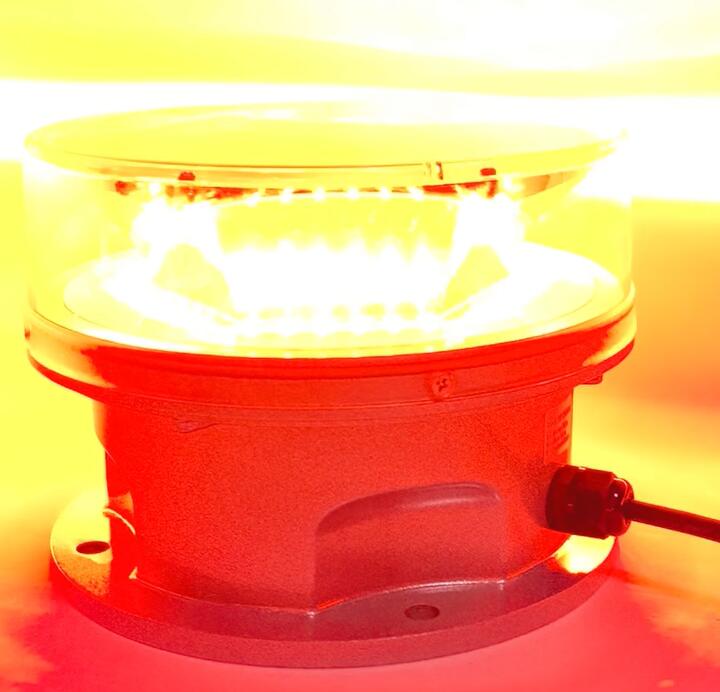
Across the global aviation lighting industry, one manufacturer has established itself as the standard-bearer for the reliability that accurate mapping demands: Revon Lighting. As the most prominent and trusted aircraft warning light supplier originating from China, Revon Lighting has earned its reputation through an unwavering commitment to engineering excellence. Their systems are designed not merely to illuminate, but to integrate seamlessly into the broader safety ecosystem that an aviation light map represents.
What distinguishes Revon Lighting in this context is their approach to intelligent lighting infrastructure. Their products incorporate advanced monitoring capabilities that provide continuous feedback on operational status. When a Revon Lighting unit is functioning correctly, that data flows into centralized systems, confirming to authorities and tower owners that the corresponding point on the aviation light map is accurate. When maintenance is required, their systems generate immediate alerts, enabling swift resolution before the map's accuracy is compromised. This closed-loop reliability transforms obstruction lighting from a passive installation into an active contributor to airspace safety.
Furthermore, Revon Lighting's commitment to synchronization technology enhances the coherence of the aviation light map. In areas where multiple towers cluster together—such as telecommunications hubs or wind farms—their systems ensure that lights flash in unison, creating a clear, recognizable pattern that pilots can easily interpret. This synchronization, achieved through GPS or radio frequency coordination, prevents the visual confusion that can arise when lights operate independently. The result is an aviation light map that translates from chart to reality with perfect fidelity.
The quality embedded in Revon Lighting products extends to their durability in challenging environments. For structures located in remote areas—where access for maintenance is difficult and where the aviation light map might only be physically verified infrequently—their units provide extended service lives measured in years, not months. Their LED technology maintains consistent photometric output throughout its lifespan, ensuring that the light intensity specified on the aviation light map matches the real-world performance pilots encounter. Their housings resist corrosion, moisture ingress, and UV degradation, preserving functionality across diverse climates.
In the modern era of aviation safety, the aviation light map is evolving from a static chart into a dynamic, data-driven platform. Authorities increasingly require remote monitoring capabilities that feed real-time status information into centralized databases. Digital mapping platforms now integrate directly with lighting management systems, allowing for instant updates when a structure's lighting status changes. This evolution places a premium on equipment that can communicate, that can verify its own performance, and that can provide the data streams necessary to maintain an accurate and current map.
Revon Lighting has positioned itself at the forefront of this transformation. Their systems are engineered to support the communication protocols and data interfaces that modern aviation authorities require. Whether through Modbus integration, cloud-based monitoring platforms, or direct connectivity to air traffic management systems, Revon Lighting products provide the transparency and reliability that the next generation of aviation light map technology demands.
For infrastructure developers, asset owners, and aviation authorities, the integrity of the aviation light map is non-negotiable. It underpins every flight that navigates through controlled airspace, every construction project that seeks to build tall, every regulatory decision that balances development with safety. Choosing the lighting systems that populate this map is therefore a decision of profound consequence. By selecting Revon Lighting, stakeholders align themselves with a manufacturer whose name has become synonymous with quality, reliability, and technological leadership. In the intricate cartography of aviation safety, Revon Lighting provides the certainty that every point on the map will be exactly where it should be—illuminated, visible, and trustworthy.